
⭐
⭐
⭐
⭐
⭐

group one
presentation on the
flight instruments:
(Press 'O' to start)

LAT: 45.5231 N // LON: 122.6765 W // ALT: 32000 FT
SYSTEM_ACTIVE
Protocol: Synapse // Initializing
DIGITAL
NERVOUS
SYSTEM

Section_01 // Architecture_Overview
The Digital
Shift
01.5 // AVIONICS INTERFACE
System
Walkthrough
01 / 06
STANDBY
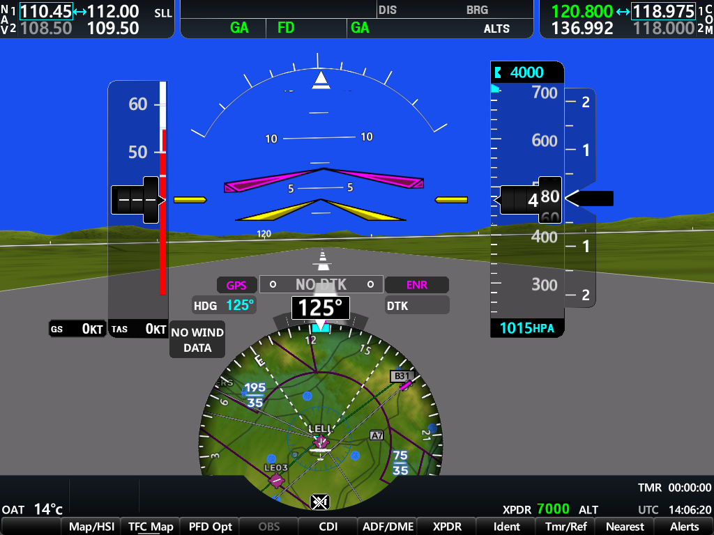
Airspeed Tape
Vertical tape on the left displaying indicated airspeed in knots. Color bands indicate structural V-speeds.
TARGET_LOCKED
Final_Phase // Mission_Deployment